Never Miss a Beat: Get a snapshot of the issues affecting the IT industry straight to your inbox.
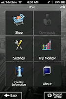
Find your way around town or across country with one of these navigation applications for your iPhone.
21 Min Read

We have updated this review for 2013. Click here to read the 2013 edition of our Top iOS GPS Apps review.
I have the worst sense of direction in the world. I couldn't find my way out of a wet paper bag with a fork and a flashlight. To complicate matters, I'm a guy, and guys don't stop and ask for directions.
I've used personal navigation assistants--PDAs or smartphones equipped with GPS--since 2004, and have graduated to navigating using both Android phones and iPhones. Pricing for navigation apps has changed over the years. You used to be able to buy the app with maps for one price and be done with it. Now, after your initial purchase, most navigation app publishers charge a subscription fee for the maps you need, or for other services such as live traffic. Maps can range in price from $0.99 to $30.00 or more.
Still, I wouldn't be without a GPS app. On Android, Google Maps Navigation is an awesome application and free to boot. No one has beat it yet. On my iPhone 4S, though, I'm at a navigational disadvantage. Google Maps for iOS hasn't seen any real improvement since July 2008.
To remedy my problem, I decided to take several GPS apps for the iPhone for a spin. I looked at nine in all. My favorites? TomTom for iOS was the best, followed by iGo primo, Garmin StreetPilot onDemand, Skobbler GPS Navigation 2, and Magellan RoadMate North America.
Apps that come with maps, or without?
All GPS apps obviously need maps to work. The question is, which is better: a storage-based GPS app, which comes bundled with maps, or a connectivity-based app, which downloads maps over a cellular connection as needed? Each has its pros and cons.
Connectivity-based apps offer the freshest, most up-to-date maps possible. The downside is that you'll need a solid 3G or 4G cellular data connection. Anything slower, such as GPRS or EDGE, won't work well, as your vehicle is likely going to be moving faster than your device can download data. In metropolitan areas where the coverage is good, this might not be an issue. But when you're driving out in the middle of nowhere, with spotty cell coverage, a connectivity-based GPS app might let you down.
Storage-based navigation apps get their maps a couple of different ways. Some apps download the entire map at time of purchase. Others let you purchase maps from within the app. Either way, all you'll need is a Wi-Fi connection. Though they conveniently don't require a cellular connection, storage-based GPS apps have their own drawbacks:
Maps take up lots of space.
Maps and their metadata (points of interest, etc.) aren't small files. Accordingly you might have to cut back on the photos, music, videos, and other apps you keep on your iPhone. The storage-based navigation apps I looked at each needed a total of between 1.25 GB and 1.75 GB of space on my iPhone.Maps become outdated.
The biggest problem with any storage-based navigation app is that the maps get old. After about six months, the data in general is considered outdated. According to the US Department of Transportation, 15% of U.S. roads change every year. Most storage-based GPS apps offer some kind of annual subscription for refreshed maps. If you find an app you like and know you're going to use it, invest in the map subscription. Subscriptions usually cover two to four updates a year.A final word before we get to the reviews. There's been a lot of information released about the NTSB's distracted driving recommendations. Although I don't agree with all of their conclusions, the point about distracted driving is well taken. It should go without saying that you should download apps and set up your phone for navigation before you drive--not during.
We have updated this review for 2013. Click here to read the 2013 edition of our Top iOS GPS Apps review.
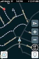
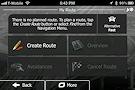
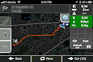
 With TomTom for iOS you never have to worry about outdated maps, ever. TomTom updates maps automatically, free of charge. It works like this: You get a notification that a map update is available, and then you can download it over a 3G/4G cellular connection--say in your car, just before driving. This is a huge deal for a storage-based GPS app.
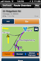
Another plus: the iOS app uses TomTom's IQ Routes technology to recommend the fastest route. In the U.S. and Canada, IQ Routes estimates travel time based on actual anonymous user travel times collected not only for the route, but time of day and day of the week. This gives you a more accurate travel time because things like rush hour, pedestrian crosswalks, and traffic lights are factored in along with the speed limit. If you want to up your game even further, IQ Routes works in conjunction with TomTom HD Traffic, a $19.99 annual subscription service you can buy in-app. HD Traffic delivers live and comprehensive traffic information every two minutes.
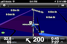
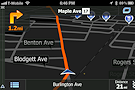
Navigating with TomTom for iOS was a stress-free experience. Advanced Lane Guidance, another feature for U.S. and Canada driving, tells you which lane you should be in when approaching a tricky juncture. I've not missed an exit or interstate transition yet, thanks to this system with its pulsing green arrows and photorealistic images. I also liked how the software displayed my actual speed vs. the speed limit--e.g. 50/45 mph--in a corner of the screen.
At $59.99, not including $19.99 for a year of HD Traffic, TomTom for iOS is one of the most expensive navigation apps here, but it's a really great choice. It works not only with the iPhone's internal GPS receiver but with most external receivers as well.
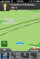
TomTom for iOS
$59.99/$89.99 (maps included)
iTunes – US & Canada, iTunes - Western Europe


We have updated this review for 2013. Click here to read the 2013 edition of our Top iOS GPS Apps review.
iGo primo
iGo primo has decent graphics, including both 2D and 3D navigation displays. My iPhone 4S had no problem getting and retaining a decent GPS signal in testing and my onscreen location was very accurate, generally matching my actual geographic position.
There is a free, maps-only "lite" version of iGo primo that lets you search for points of interest near you. The full app, which I looked at, provides unlimited navigation including an on-board map.
Using text-to-language technology, iGo primo correctly pronounces city, street, and highway names as it guides you to your destination. It can also read out a summary of the planned route, traffic events, and relevant country info after crossing a national border. Choose from seven different languages: English, French, German, Italian, Spanish, Portuguese, and Russian.
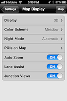
Another standout feature is its realistic junction view capability, which provides true-to-life images of motorway junctions. This is a huge boon, especially if you're making the "great American road trip" and driving places you've never been. Knowing exactly what the exit you're supposed to take looks like can be a big deal.
One of iGo primo's other advantages is its optional Live Traffic add-on software. Live Traffic lets you see road congestion and traffic jam information in real time, and iGo primo automatically generates alternative routes based on this up-to-date info. You don't have to lift a finger. In addition to North America (an extra $37.99), Live Traffic is available for Europe, Italy, France, Scandinavia, Benelux, Brazil, and Russia.
iGo primo
$24.99/$89.99 (maps included)
iTunes – North America, iTunes – Europe


We have updated this review for 2013. Click here to read the 2013 edition of our Top iOS GPS Apps review.
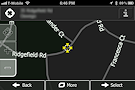
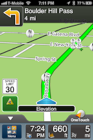
Garmin StreetPilot on Demand
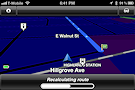
Garmin StreetPilot on Demand is a connectivity-based navigation app. If you don't have a solid 3G or 4G cellular connection to access the online maps it needs, the app won't work. StreetPilot's menus and screens are nothing special--not ugly but not stunning like Skrobble's, either. But this app is exceptionally accurate and responsive. When rerouting, it did a stellar job of using the current location as the new starting point for the trip. This method of route recalculation took a few moments longer to complete, but it was preferable to the method used by Skobbler GPS Navigation 2, which seemed to reroute me only back to its originally discovered route, instead of recalculating the entire route.
Garmin's Local Search function is powered by Google, and from a navigational perspective, is somewhat comparable to Google Maps, though it does not present the same Internet Yellow Pages profile when presenting results. I did think that it was the best app in this roundup for local search, however.
My biggest beef is the big blue car the app uses to represent your current location. It's certainly easy to see--but it's so big I found it distracting. Other apps' current-location graphics are not as intrusive.
Garmin Street Pilot on Demand is $0.99. Navigation with its on demand maps is $2.99 per month or $29.99 per year via in-app purchase. Subscriptions auto-renew until cancelled.
Garmin Street Pilot
$0.99 (requires cellular connection)
iTunes – Universal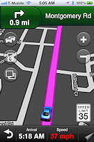


We have updated this review for 2013. Click here to read the 2013 edition of our Top iOS GPS Apps review.
Skobbler GPS Navigation 2
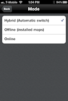
For a 99-cent app, Skobbler GPS Navigation 2 has some nice features. For one, it's the first navigation app I've seen that uses both storage- and connectivity-based navigation. This hybrid approach ensures you have both the app responsiveness you get from having maps on your device, and the up-to-date data that you get from connectivity-based navigation. You'll still need a reliable 3G/4G cellular connection, though, for the app to work.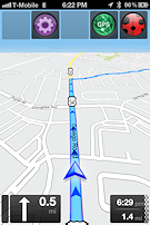
Although the navigation screens are rather plain--downright ugly compared with TomTom or iGo primo--the menus are visually stunning. Moreover, they should be a breeze to use for both U.S. and European drivers. After nearly 10 years of reviewing navigation apps, I've noticed that Europeans use navigation apps differently than U.S. drivers do; for example, few Europeans make extremely long road trips--they tend to use public transportation such as rail instead. But Skobbler seems to have cracked the menu navigation nut and has pulled together an application that should work well for both major markets.
Unfortunately, the app has some navigation problems. For instance, even though the app indicated that it had a good GPS signal lock, its position of my vehicle vs. the actual location was inaccurate, off by what seemed like 30 to 60 feet. If I could not follow the documented route, it took the app about 20 seconds to acknowledge that fact and recalculate its route to match the new starting point or location. Even then it seemed as though the app was determined to route me through its originally calculated path. It led to a lot of unnecessary route recalculations and illegal U turns.
In addition to accuracy problems, the app suffered from a great deal of jitter. The screen never seemed to orient itself correctly based on my direction of travel. If and when it did, the screen turned and bounced. I'm not sure if my problems were caused by the app's use of OpenStreetMap or programming issues, but the whole experience was disappointing.
Navigation used to be online only and subscription based ($3/month, $30/year). Now you can opt for online, offline via downloadable maps, or both. You can buy off-line maps by country for $3.99 each, continent for $5.99 each, or global for $9.99.
Skobbler GPS Navigation 2
$0.99 (hybrid: maps included, but also requires cellular connection)
iTunes – US/Can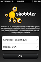


We have updated this review for 2013. Click here to read the 2013 edition of our Top iOS GPS Apps review.
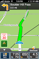
Magellan RoadMate North America
Magellan is an acceptable GPS app--if you can overlook a less-than-perfect interface and some quirks. The app provides smooth voice-guided navigation with subtle chimes at turns or direction changes. However, of the three storage-based apps, I found Magellan's displays to be the least helpful. Unlike iGo primo and TomTom, which display your actual speed, Magellan instead shows a road sign graphic that displays the current posted speed limit. When you go over the speed limit (by a configurable amount--the default is the posted speed), the road sign changes from black on white to red on white. This is less-than-helpful compared with the other apps' actual speed display.
Traffic alerts come up as a green square with a hazard sign inside it, prompting the driver to tap, read, and interact with the app while driving. Not a good idea.
I found the way Magellan handles point-of-interest icons distracting as well. The icons grow (or get smaller) in size based on your distance away from the gas station, restaurant, etc. I found myself squinting to make out what an individual icon might be until it became recognizable. Both TomTom and iGo primo display their point-of-interest icons at a static size.
The voice-guided navigation was fine, although at times the female voice sounded either intoxicated or like someone with marbles in her mouth. Every time she pronounced "twenty" as "dwendy," I half expected to hear a followup "hic!" Voice-guided navigation also is available in Spanish and French but I don't know if it's as funny in those languages.
The biggest disappointment, though, was the iOS app's lack of integration with Magellan's Premium Car Kit for iPhone, which I recently picked up (a video review for BYTE is in the works). You would expect that when you pair two, same-branded products together with Apple's most current, top-of-the-line smartphone that the experience would be breathtaking. It wasn't. I expected both app and the hardware to recognize that the other was there, and provide me with some bonus goodies--say, an enhanced navigational screen, an improved GPS lock, or some kind of Bluetooth phone enhancement. Nope. I found no compelling reason to pair Magellan's software with its car kit, over any other combination of navigation software and Magellan's car kit.
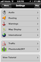
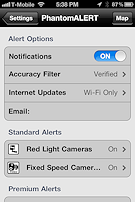
If funny navigation voices aren't your thing, Magellan RoadMate North America offers additional voices for 99 cents. Magellan includes basic safety alerts via PhantomAlert (red light cameras, fixed speed cameras). You also can buy Premium Safety Alerts (combined cameras, speed traps, rail road crossings, dangerous curves or intersections, etc.) via the controversial PhantomALERT for an annual subscription of $29.99.
Magellan RoadMate North America
$59.99 (maps included)
iTunes — North America

We have updated this review for 2013. Click here to read the 2013 edition of our Top iOS GPS Apps review.
Honorable Mentions: Other Apps You Might Like
Google Maps
Google Maps for iOS has hardly changed since its introduction as part of iOS 3.x. Its integration with Siri as part of iOS 5.x in the iPhone 4S, however, is very nice. Using its on-demand online maps, Google Maps can provide you with accurate directions from A to B while showing your current geographic location. Directions delivered either via Siri voice commands or via user input are delivered quickly and are as accurate as the maps the application pulls from. Google Maps for iOS supports both walking and car-based directions. What it can't do on the iPhone, however, is the turn-by-turn navigation that it does so flawlessly on in its Android counterpart.
Waze is part game, part serious navigation app. It got its start in the Android world, got noticed, and made the jump to iOS. Waze enlists you, the user, to help validate its on-demand maps. In return for using the application and "road munching"--gobbling up dots on unvalidated roads Pac Man style--you earn game points you can track. Waze takes the validation data and uses it to confirm that its cartography data is accurate. Users also get points for reporting accidents, speed traps, police cruiser locations, and other road happenings.
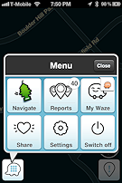
Although Waze does provide turn-by-turn navigation, and does a good job of getting you from point A to point B, the road-munching game gets to be a little tiresome after the novelty wears off. Also, for an app that displays a distracted-use warning on first startup, Waze requires way too much interaction from the driver during use. For serious or ongoing navigation needs, you should look elsewhere.
Free
(On demand) iTunes — Universal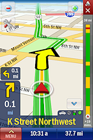
At $14.99, CoPilot Live is one of the most affordable storage-based navigation apps for iOS there is, and an overall good choice. The top five apps in our roundup only just edged it out. CoPilot's interactive, tap-and-drag route editing is truly innovative. The downside, of course, is that the more you have to interact with a navigation app while driving the more distracted you'll be.
Like TomTom and iGo primo, CoPilot Live supports lane indicators and realistic signpost info to make tricky turns and interchanges easier to negotiate. This kind of assistance is becoming very popular and more of the better apps will have it as time goes on. A storage-based app, CoPilot Live comes loaded up with maps. Its ALK MapSure service provides monthly, free in-app map improvements and full quarterly map updates. It also supports live traffic in a yearly subscription model as an in-app purchase. The subscription automatically renews until cancelled.
$14.99
Free map updates
(Storage) iTunes — USA, iTunes — Europe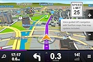
Sygic is a storage-based navigation app that uses maps from TomTom for iOS to guide users via voice-guided GPS navigation. Sygic supports hardware-accelerated 3D rendering as well as Apple's retina display. The app is also optimized for iPhone 4S, iPad 2, and the new iPad. Sygic is compatible with iOS 5 and contains support for iCloud. You can back up your favorite points of interest and your settings, history, Favorites and Travel Book.
Most navigation app displays tend to be rather plain. Sygic's screens, however, contain a great level of detail--maybe too much, in fact, especially in metropolitan areas. The screens can be a bit on the busy side, and that can be somewhat distracting. Its safety features, however, provide a great deal of comfort. Its road incident sharing and real-time incident notifications can help you navigate around accidents and traffic snarls. Its audio stream can also be pushed through your car's audio system either via Bluetooth or auxiliary cable.
$29.99
Free map updates
(Storage) iTunes — US, iTunes — Europe
We have updated this review for 2013. Click here to read the 2013 edition of our Top iOS GPS Apps review.
Connectivity matters--but so do looks
Storage-based navigation apps provide you with most if not all of the data you need to confidently navigate almost anywhere. However, they require a great deal--a minimum of up to 10%--of your total storage space for all of their data. Connectivity-based navigation apps are easier on the storage requirements, but require a reliable, high-speed cellular Internet connection.
That said, in my tests having North American or U.S. map data on my iPhone 4S wasn't an issue for me--I had plenty of room left over. Neither was connectivity a problem, at least in well-covered metropolitan areas and on well-traveled U.S. interstates. In Chicago, for example, my carrier, T-Mobile, gave me reliable coverage, and I've got plenty of 4G goodness via my Sonic 4G Wireless Hotspot. But on weekends, or when I didn't have my hotspot handy, navigation via connectivity-based navigation apps didn't always come through. Although EDGE on an iPhone is OK for most non-data intensive stuff (status updates on Twitter and/or Facebook, texting, calls, etc.), staying inside a 3G/4G coverage area is needed for connectivity-based navigation solutions.
At the end of the day, which app is best for you can be a coin toss. How much you like the navigation screens also matters a lot. Pick the one that not only performs well, but seems like it would be the most visually appealing to you. This thing is going to be running in your car, talking to you, for probably as long as you have your iPhone. No matter how accurate it is or how well it performs, if you don't like the app you won't use it.
As a final point, if you do decide to go with a connectivity-based navigation system, you should think long and hard about whether your intended route will support a signal, whether you're going out of state or to a local but unfamiliar area. Having your map go out on you due to lack of signal isn't something that gets covered in any app's user manual, but is something you'll want to avoid. Check your coverage area before you start out, and make sure you're going to have the connectivity you need. After all, if your GPS app isn't there for you when you need it, why have one?
About the Author(s)
You May Also Like
More Insights
Editor's Choice


May 2, 2024
While there are plentiful options in cyber resiliency and business continuity tools and platforms, there isn’t one that can knock out everything from sudden cloud outages to prolonged ransomware attacks in a single punch. What can you do to keep the company on its feet no matter what is thrown at it? Find out in this new virtual event.
Reserve Your Seat Now